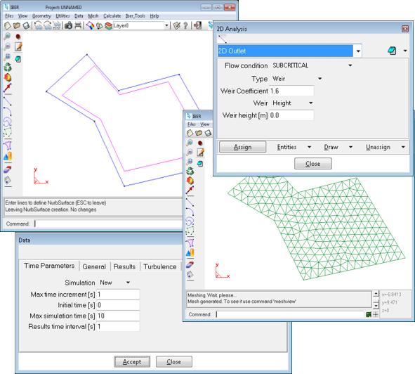
Pre- and Post-processing
Iber implements a powerfull and friendly interface for pre-processing and post-processing, which is compatible with GIS environments.
This interface is based on GiD software, a tool developed by CIMNE for numerical simulations in science and engineering. Iber is fully integrated in GiD as a calculation module in order to help the user to generate the project, but Iber itself can be also used apart of GiD.
Pre-processing
Features of the pre-processing interface:
- CAD applications in the design of geometries
- Generation of structured and unstructured meshes using different meshing algorithms
- Ability to import geo-referenced images
- Definition of spatially variable properties and calculation parameters
- Possibility to automatically import bed roughness from geo-referenced land use data
- Possibility to resume a calculation from a hotstart file
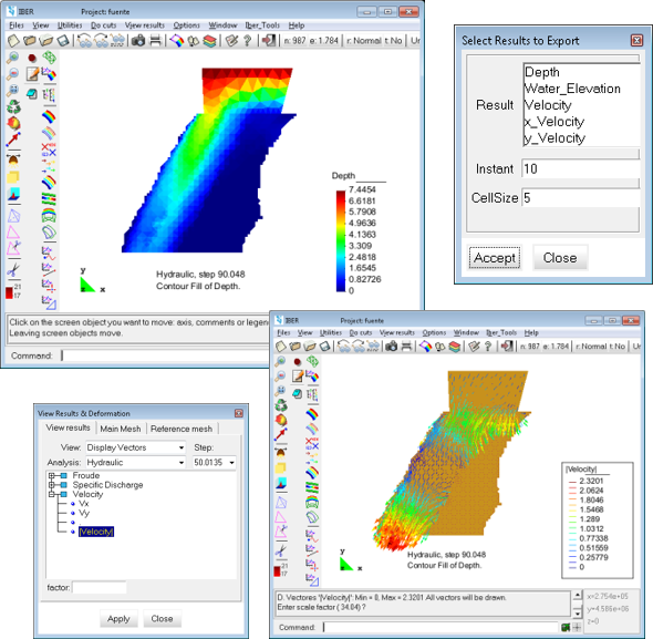
Post-processing
Features of the post-processing interface:
- Visualization of 2D scalar and vector fields
- Visualization of longitudinal profiles and sections
- Visualization of temporary results while the simulation is carried out
- Visualization of the flood risk areas
- Tools for displaying the results in GIS format
- Results exported in raster format to be displayed directly in GIS environments
- Visualization of the results over geo-referenced images
- Creation of videos with animated unsteady results
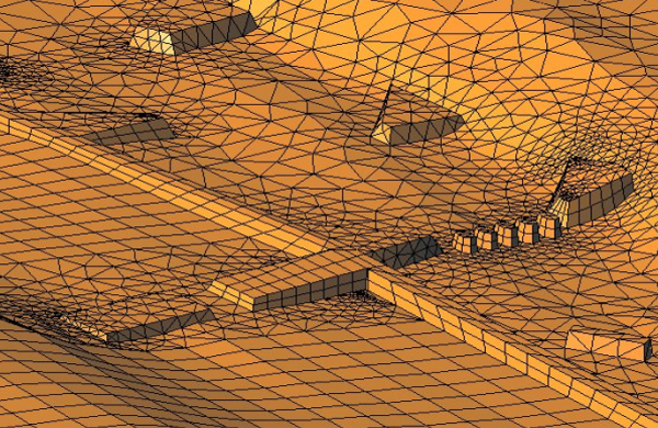
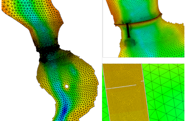
Mesh generator
One of the processes that require more time and effort in developing a numerical simulation in rivers is the generation of the numerical mesh.
A river has an irregular geometry and the construction of an efficient mesh is not straightforward. The meshing methods based on the chordal error (maximum difference between the original field and the mesh) are very appropriate in order to minimize the number of elements with smooth transitions.
Iber includes the following mesh generation methods:
- Structured and non-structured meshes (coupled)
- Triangulated irregular mesh generated using the chordal error
- Meshes based on RTIN (Rectangular Triangulated Irregular Network), generated using the chordal error
- Regular mesh directly generated from a DTM (Digital Terrain Model)
- GDAL library for mesh importation and generation
For these methodologies, a Digital Terrain Model in arc / Info ASCII format is required as baseline information. Furthermore, several mesh format can be directly imported too.